Monthly Archives: October 2019

A Norwalk Ohio memory

If you were going back in time

it wouldn’t be to the day you got bit by a big dog, would it?

A quiet day in 1959 or ‘60.

They were all young guys and gals back then. The grown ups.

Cool crew cuts, Ohio 1950’s.

My uncle from Chicago was young, fit his belongings in the first Volkswagen we ever saw. Had a tiny oval rear window and the engine in the back. Strange. That was a head-scratcher. Eccentricity and freedom.

Our dad, a dad with four kids running,

grasshoppers leaping from blade to blade in the sun.

I remember the day I was bit by the dog. I was maybe three or four.

Kids gathered in a clump when Pinky the neighbor dog made his jump.

A little boy of three will reach for things to toss to play – but not the gnaw-bone of a beautiful Weimaraner.

Jaw bone to jaw bone Pink and me.

Big dog / little boy that’s how it was.

Pinky lunges for the jugular. Who can blame him?

There was a shady tree to tumble by. Chased by the dog.

-Or maybe the dog just nipped and jumped and didn’t follow. My memory is a jiggly camera.

But I imagine the dog’s bounding slow motion perfection.

Me, stumbling, a little boy in overalls tumbling.

Bounding and tumbling: such is life.

Looking back, the hills flatten out

into such little slopes.

My big hill wasn’t all that. How did we sled down that in winter?

But this day was in the days of corn on the cob and lightening bugs

and a big dog named Pinky and me on the run.

We were all so young and alive!

On the drive to the doctor, my little chin wrapped in a terry cloth towel, I guess they loaded me into the car quick- Pop was a medic in the army during the war – my mom’s younger brother, holding me still in the passenger’s seat while Pop drove fast.

I still have the scar 60 years later.

There it is. On the jaw line, inches from my throat. That must have been such a tiny measurement on a little boy of 3 or 4.

My uncle was there saving my little peanut of a life!

What happened next? Most of our lives happened after that.

Paint a picture of an apple tree in bloom, a circle of shade, a tumbling boy, a beautiful dog in mid-air. All the adults you ever knew were young. Show them smiling and waving, which they were. Call it my garden of life.

By all means go back. But come back soon. There’s more work to do.

jk

for herb pfeiffer

4/21/2018

***

Ballad of Wolf Faced Eel

It’s been two years since my uncle passed. A brilliant man with an engineering skill for fixing things and a love of the arts and Japanese society.

While I’m waiting to write the serious thing about my uncle who sadly has passed away…

I’ll write about my friend Tibetan former monk who fixed the TV with a piece of string

Someone lost broke threw away or accidentally stole the remote for the wall- mounted tv in our office at work which has a hidden on/off switch very difficult to access and too far to walk to change stations

so former monk applied looped strong cord -simple string -to hidden recessed switch, measured amount of string to reach stolen comfortable plush ergonomic reclining executive office chair (where did monk get that?)

and tested cord with a slight pull to the left and voila cable channel advanced to next station.

Further devised a means – by a large loop behind ears to change the channel remotely by nodding his head.

“Working now” he informed me.

We watch favorite station Blue Planet between calls and shout when we see a creature we want to be reincarnated as.

“Wolf-faced eel!” I shouted.

He clapped with approval. Wolf-faced eel is actually an exquisitely prehistoric-looking fish that can eat spiny sea urchins.

“Bottle nosed dolphin-Big Brain!”

“Coral Reef”!

Other workers arrived and asked to watch “Judge Judy”. The monk nodded many, many times.
jk
4/6/18

thinking of you uncle obie

***

Tibetan monk innovation:

This is Tibet monk’s sound system” for his iPhone. The phone is inserted in center slot of the cardboard tube, upright for viewing screen, and the tiny speaker is amplified by the resonating tube. Two small push pins support the device on the table top. The paper cups are the speakers, and themselves add a bit of graphic design as well.

***

***

My art history teacher encouraged my writing

Portola/ Sweeney Ridge (California beginnings, one of many)

Poem/ Portolá

In the morning

ravens claim their usual branch-

They talk:

The opaque fog, the atmosphere the redwoods love,

We see it every day-

when

the garage door lifts:

Ah California!

It’s a quick march

for the would-be conquistadors,

our commute,

the view across the valley to San Bruno Mountain;

the cafe where we get pie

strawberry rhubarb pie!

Or northward, the morning window vision

hawk, Marin and

Monterey pine.

On Sweeney Ridge

on Skyline, you’ll find their site

beneath the parking lot on the crown of the ridge,

ocean at your feet

traffic roaring by:

(a california discovery poem from the box the bedroom floor every draft is a rough draft.)

A Historic Discovery

250 years ago the Portola expedition “discovered” San Francisco Bay, on this ridge in San Bruno, not far from Shari’s Cafe and Pies, where we discovered really good rhubarb pie.

This is the view they would’ve had, although here the bay is hidden by trees.

Ah California!

the view across the valley to San Bruno Mountain (when the fog lifts)

the cafe where we get pie

strawberry rhubarb pie!

On Sweeney Ridge

on Skyline, you’ll find their site

beneath the parking lot on the crown of the ridge,

ocean at your feet

traffic roaring by:

(a california discovery where all drafts are rough drafts.)

Bridge at the Gate

Here again, a bridge

geographically important in the sense of dreams

At its south tower

a waterfall over stones

and there, across marbled water

a vast brilliant pane of blue

the span in its simplest form,

an arc penciled in

not yet complete

the water barely covered our feet pacific ocean not yet filled in and

the bridge aloft above us like a sleek metallic bird in air span to span;

to see that, to climb and look over

to perhaps throw a stone

from this dream to the next

breathing adventure again

Into all those cells and molecules

cmon on kids let’s go

so I followed

jk

10/25/18

A Springtime Story for the Lincolns

A Springtime Story for the Lincolns

I once I heard a diplomat on the world stage remark to an audience that observers often took issue with his smiling countenance, especially during times of crisis. The diplomat disclosed that he tended to smile often, and then said:

“I must learn to not smile so much.”

This reminded me so much of Lincoln, and will allow me the chance to tell a story or two, for April 14th is the memory day of the death of Lincoln, serious as it is. I want to write about it and see what it means today.

***

Lincoln never saw San Francisco, but had he lived he would’ve visited. How do I know? He said so, on his last day, April 14, 1865. He spoke with a California congressman, and the subject of the visit came up. Lincoln said “You are going to California, I hear. How I would rejoice to make that trip!- but public duties chain me down here and I can only envy you its pleasures.”

I like to think of Mr Lincoln laughing at our hills and crazy weather and the little gold-dust tornadoes that supposedly appear spontaneously here and there. It is easy to imagine Lincoln here, to imagine remarks about tying the nation together by a visit to California; or a story about the old woman and a mule called Progress; or delightfully surreal descriptions of earthquakes, and old jokes that would be obvious and still funny with each retelling. As the Lincolns clip-clop by horse-car or carriage down Market Street or up Montgomery, they would be amazed at the diversity of the inhabitants. How Mary would’ve loved San Francisco! They would dine at the Cliff House by the sea, and there’s no question that Lincoln would’ve loved the drastic melancholy and drama of the Pacific Ocean. Perhaps he would turn to Mary and say, “Look at all that water!” And Mary would give him the Look.

***

You know, George W Bush is not far from from that kind of remark, and would know keenly the criticism directed at Lincoln. I have to give it to to the president; Mr Bush too, has had a hand in creating his own folklore, and will probably be remembered for his folksy, unadorned style- deservedly so.

There is no question that Lincoln would be delighted with the famous Bush malaprop, “They have misunderestimated me!” and would add it to his stock of stories.

Lincoln paid an emotional price, and a potentially political one, after the battle of Antietam, when he failed to effect a gravity of expression, and asked to hear a tune as he left the battlefield. This was considered a horrid lapse of taste, and was used by his enemies for a long time thereafter.

He was lambasted continually, for the story spread widely and it grieved him- he smiled too much.

***

When he told jokes at cabinet meetings he was met with looks of stone silence, but despite this he was always ready with a story. Some were annoyed, but friends who loved him saw the dour expression and twinkle and knew that a good story was a-comin’. Sometimes he would make everyone wait and stare at him for a long moment before he began.

A final photograph of Lincoln is a little fortuitous miracle, for in it he shows us the now famous Mona Lisa-like smile of recognition near the war’s end. A miracle, for the photographic plate was broken and would’ve been thrown away. But here he greets us, and communes with future Americans in a friendly and honest way.

It’s a great mystery for historians, that smile.

For Lincoln’s face was impossible to photograph. The animation and amusement returned only after the picture was taken, and that, perhaps, is the perfect element of humor, the utter gravity of that face. Lincoln no doubt would say it broke the negative.

Consider this description of him laughing, that his face crinkled up, he grabbed his knees and stomped his feet and nodded and nearly cried tears at a good story. Stone cold sober, Lincoln kept the other lawyers up late nights laughing.

-And he wrote the Gettysburg Address.

***

That people make a demand of propriety which is not always possible to fulfill, is a truism for George W Bush as it was for his great predecessor. As Bush slings a few nicknames at reporters, sometimes Lincoln would leave statesmen standing while he would unlimber and chat with a newsboy; elbows out, hands clasped behind his head, long extended. Stretched out- forever.

***

So my California dream, Civil War style, is based upon a sunny afternoon conversation with Lincoln on his last day on earth.

Good Friday. Glorious nation at peace. I think Lincoln pulled lemons off the tree for a visitor. The usual conversations were all brief, friendly, and subdued. Lincoln looked happy. Think opulent sunshine, blue sky, green grass and roses. Dogwood in bloom. Spring and peace filled the atmosphere at the White House. And at night, illuminations all over the city, brighter than the stars. I think he worked a half day, and went for a carriage ride with Mary. It was such a beautiful spring day.

And then there was horror that night I won’t retell it but it not mention that Lincoln’s son Tad, age 12, was also at the theater, but Tad was at Grover’s not at Ford’s with his parents. He was seeing the play “Aladdin” when he heard of the shooting. When it was announced to the stunned public that his father had been shot, Tad was seen alone, “running from the theater like a deer.”

Running from the theater like a deer…

Lincoln, Mary and Tad. Gone long since, 138 years or so.

***

I have a newspaper clipping in one of my Lincoln books from many decades ago. It has yelllowed with age.

In it, a reporter wrote about his grandmother’s memory of Lincoln lying in state in New York. She was there, a young woman then. I think the reporter was a boy at the time of the interview with his grandma, with a homework assignment on History.

The young reporter asked, “How did Mr. Lincoln look?”

And his grandma replied, “Well, he didn’t look too good.”

That was not a sufficient report, so his grandmother went on to describe the marble pallor, the slight smile, the black suit from the second inaugural, and then, how at the funeral pageant she and her girlfriend nearly got in trouble for giggling and flirting with a handsome soldier- he startled the girls into seriousness with a grand wave of his sword in the direction of the coffin. Grandma explained that he was saying: “Mind your manners, and think of Mr Lincoln.”

Just so: Mind your manners and think of Mr Lincoln. And don’t smile too much.

***

Honest Abe did not lie undisturbed. Grave robbers made an attempt in 1876, and officials had the body moved several times until an occasion in 1901, when Lincoln’s face in death was last seen, at a little private ceremony. Before a final interment, in a newly constructed secure vault, an aperture was made in the coffin through which the little assembly could peer and take a last look at Lincoln.

Mildew had settled, but the hawk nose, little tie and inaugural suit were recognized. In a fully Industrial Age he had helped to create, Lincoln was lowered into a cage of iron and concrete ten feet down in the ground in Illinois. This morbidly fascinating event scared the youngest witness, who said. “I didn’t sleep well for a good long time after that!” The lifetime of that witness overlapped mine, I learned. Lincoln’s direct family line too, was gone by the mid-nineteen fifties.

***

So Lincoln thenceforth rested undisturbed- except by the writers who keep prying open the whole episode again? Why? What’s this all about, this remembrance?

I look at a lithograph of the scene at Ford’s Theater, April 14, 1865, and notice the box from which the assassin leapt; the footlights on the stage below, the American flags draped here and there; it is truly a star-spangled tableau. Its melodrama is highlighted by the art of the print. Flags and bunting and even a framed picture of George Washington adorn the scene.

How we paint everything in red white and blue! We create our silent tributes and tableaux. How beautiful they are. Below the televised war (Iraq) is the banner of freedom, framing the tv screen, the commercial for ourselves. It colors everything we do. The flag is waving, the band is playing, the drums rolling. On we go.

But the morning after the assassination there was no pageantry at all, just the little hearse rolling back to the White House in the rain. An escort of only ten soldiers. And Mary Lincoln ever after, in the old hotel with the shades permanently drawn.

And the doctors in the upper room at the White House that morning found the bullet that changed history. It dropped into the basin with a dull ping.

While we rewrite history to suit ourselves, we still confront its sad realities sometime.

***

Let me return to the present for now.

This week, in April 2003, President and Mrs Bush visited wounded veterans and spoke briefly to the nation. One of the hospitalized soldiers was on life support- “wired up”, according to President Bush’s awkward description…and it reminded me of the time Mr Lincoln, spontaneously shedding a tear at the side of a wounded young officer said, “Please live, don’t die- you must not die!”

-To which the young officer replied, “I don’t intend to, sir.”

I wonder if Mr Bush knows this story. I get the feeling he would really enjoy it. There is a sense of humor in George W Bush which is quite in keeping with this tale.

The little scene with the President and Mrs Bush at the hospital reminded me of the days in history when the Lincolns invented these roles, and they too were astonished at the courage reflected back at them by the combat veterans they visited. The Lincolns visited the wounded as often as possible, to comfort them, and to rejuvenate themselves. It seemed to be an activity they truly enjoyed.

It makes sense that the Lincolns would draw near us during wartime, would care for the soldiers, and would care for the nation now. Lincoln would bring strength, much needed diplomacy, and as for Mrs Lincoln, it would be her utmost anxiety to inspire the people with courage.

Lately I have been looking for a way to forgive, to feel inspired again, and perhaps to acknowledge and remember Mr Lincoln is a way to feel that, and also to regain a sense of union, perhaps just for this day, perhaps just for this moment.

And in doing so here, I have probably rewritten history the way I want it to be. That is fine. For me, then, it is a day in spring, the war is winding down- and the Lincolns are bound for California.

jk

April 15, 2003

postscript: I just read quite by accident that Lincoln was once caught by Mary using a gold fork to feed the cat. To her stern look, he replied,

“Well, if it’s good enough for President Buchanan, it’s good enough for Tabby.”

***

Hey, Lincoln wrote about Niagara in 1848, notes of ideas for a lecture. Unlike my silly made-up anecdote, here the writer’s voice is clear:

https://quod.lib.umich.edu/l/lincoln/lincoln2/1:6?rgn=div1;view=fulltext

My Bridge (An Ohio Journey- with Thoreau)

My Bridge

(An Ohio journey- with Henry Thoreau. Station Road Bridge, Brecksville Ohio. A Notebook reminiscence)

While visiting relatives in my home state, Ohio, over a holiday, I found myself unable to sleep.

So I opened the book I had brought in my carry-on: A Week On the Concord and Merrimack Rivers, by Henry David Thoreau.

Why couldn’t I sleep? After a plane flight from San Francisco, Ohio is three hours ahead of California, so perhaps that was three extra hours to stay up and think.

As a dear uncle had said pointedly, “Keep digging that trench!” -Meaning that perhaps I wasn’t really getting ahead in my little bookstore life in those days.

So, Thoreau.

Reading Thoreau wasn’t an act of individualism, or a rebellion against a conventional attitude, no different drummer thing. I just wanted to get some sleep.

I was reading as a reference to a recent article by John McPhee, which a friend had given me to read on the flight to Ohio.

This was an article in Atlantic Monthly; an account of author John McPhee’s journey retracing the route of Thoreau and his brother along the local rivers and canals in Concord, Mass. in 1839.

It inspired a re-reading of A Week on the Concord and a Merrimack Rivers- Thoreau’s first try at his new style, to be perfected in Walden or Life in the Woods.

It was a perfect Ohio book, since my holiday visit included long drives through the countryside, around the woodland parks of the Cuyahoga Valley, and walks with my sister and family along the river and down by the old Ohio and Erie Canal.

***

The Thoreau book is a favorite of mine, though my memory/retention is not that great, and my understanding of its Transcendentalism less than perfect. I had first read it shortly after the deaths of my parents in the 1980’s, only a few years apart. Natural causes.

Thoreau wrote A Week on the Concord and Merrimack Rivers as a requiem to his brother who had just died: a memory book about their journey together by boat, by river and canal in 1830’s. A series of day trips, really.

While I was reading A Week for the first time, I had I become curious about the natural history of the country, the age of the rocks around me.

Earth had become of greater interest to me after my parents’ death, and nature seemed to interact with the feeling of loss I felt.

Grief can focus the senses. One looks at life in a new way. It is the shock of the new, to borrow a phrase, to go on living. One may look to the natural world, or to the thoughts of others, for a way through.

One looks for a bridge of some sort, and finds it in nature, perhaps, or in a book.

A critic of American letters called Thoreau the great poet of loss. I can’t remember who. Does it matter? It’s like three am here.

***

Thoreau’s writing is luminous with grief. There is humor, also, in his writings, often overlooked. It’s obvious he was incapable of telling a joke, and these fall flat in his books, but when he directly engaged his audiences at his lectures with descriptions of themselves -they laughed; his delivery was spot on.

But A Week, written after his brother’s death (natural causes) shortly after their river trip, that was elegy.

Behind it all, a deeper motive; his meditations as he journeyed through landscape are not idle musings. They reflect an interest in the history of the landscape and all its inhabitants as a way through grief.

In A Week he is preoccupied with the past, both ancient and the local: fragment of poetry, or an arrowhead found by chance. Or by the fading of one simple day into another; the principle of loss and reflection is in each case the same.

***

In his book, Thoreau seems to wander, to ramble, yet his writing requires a rapt attention to follow the path of his thought.

Not all his sermons hold interest. One reads on until the writer describes with perfect accuracy his surroundings, or reveals, as a great teacher, the living art of the ancients as part of his own elegiac artistry.

Homer, the poets of Classical Greece or the scriptures of India, the Sutras- I know nothing of these, but gain something, as I read A Week. It is perfect to carry on a trip, or to read when one can’t sleep.

***

The critic Alfred Kazin notes that Thoreau did not survive the Civil War. He posits that the world of Thoreau did not survive, either.

Thoreau died of tuberculosis in 1863. He worked on his nature writings, perhaps as a counterbalance to the thought of war. Of course he had weighed in on the political issues of his day, his personal activism a matter of record.

But during the Civil War he became deathly ill. While he still had the strength, Thoreau resolved to travel, seeking improvement in the natural environment of the West. He made it to Minnesota and back.

He knew his journey might be final: on a Missouri River steamer in 1862, Thoreau heard the steamboat’s bell struck three times at the bustling dock and noted the dire sound, even wrote it out, its mournful clang.

***

In his last trip he wished to see the Indian People in their “natural” environment, but the performance he saw was already stage-managed by, and for, whites. He saw buffalo, but not the great herds, and as for flora and fauna, he was too weak to fulfill his Nature wish-list. His notebook is sparse. He returned to Concord with only a few months to live.

Still in his house were stored the hundreds of unsold volumes of A Week, his first book, which after his death were yet unbound. These upon his death were finally bound and sold to a belatedly interested public, decades later.

These posthumous second editions of A Week are, somewhat ironically, more valuable than the first editions to collectors, due to their earlier provenance.

***

My dear uncle’s teasing, while irksome, is accurate. I really didn’t do my life very well at all. Prone to addiction, perhaps a little anxiety and depression: of course I had been in a rut. I was somewhat awakened though, when I saw the potential of my week by the Ohio and Erie Canal, in terms of entwined meanings, as Henry Thoreau would have pointed out.

***

Somewhat bitter, pondering a lost world and missed opportunities, like the canal that was obsolete upon its completion, I pondered a quaint picture of the pastoral wealth of the past; the hopes and optimism, here and there placed like historical markers, put me in a better mood. I’m not upset or nostalgic, but realistic. As did Thoreau, I look both ways in the modern world: to the ancient past, insofar as it exists with us, and to the presence of the future in the present. Or whatever.

I’m awake now. And not in the insomniac sense: Awake.

***

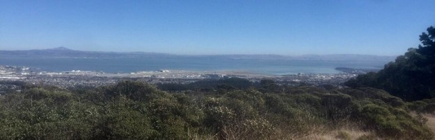
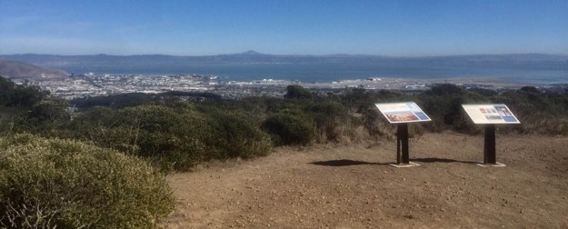
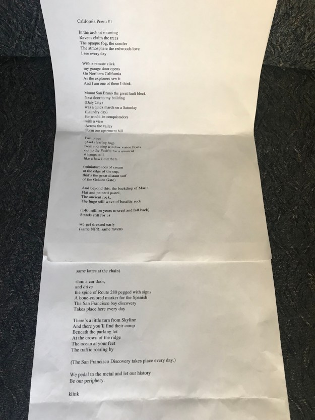
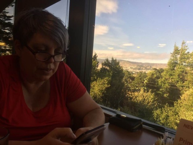
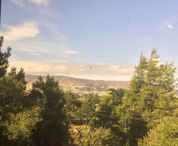
In Ohio for a week, reading the river and canal journey of Thoreau, I became curious about the Cuyahoga River and the beautiful countryside near our home town out on Riverview Road, out by the old canal. My family, along with my sister’s yellow Labrador, Chewey, went for a drive to have a look.

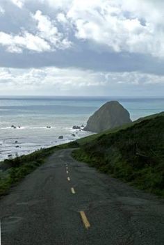
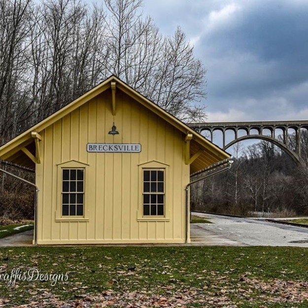
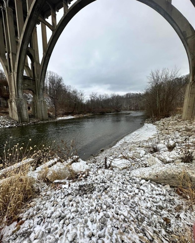
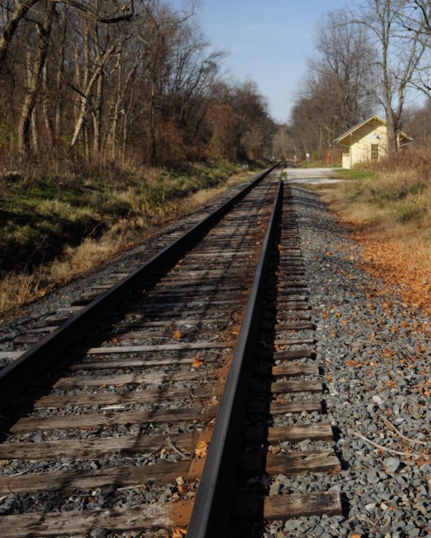
The river flows beneath a giant span, an impressive high level bridge of arches, across a chasm that is perhaps four hundred feet deep; its valley is a broad flood plain that contains a railroad, a little yellow station by the tracks, and the wide river.

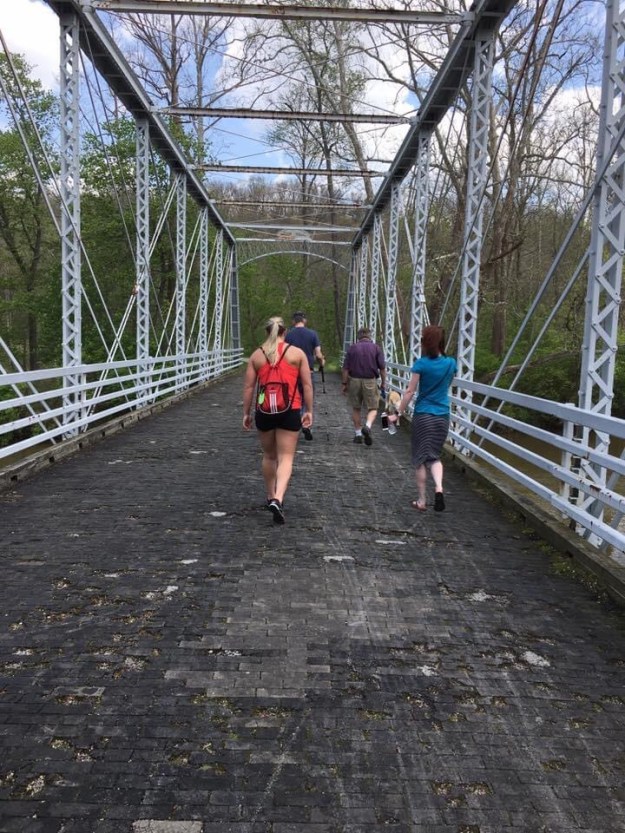
Along the east bank of the river are the remains of the old Ohio and Erie Canal. Over the canal is a small iron bridge, perhaps fifty feet long. When we got to that little bridge, the yellow lab Chewey stopped walking and refused to cross. He got part of the way, looked down and would go no further.

“Chewey doesn’t like bridges,” said my twin sister. “We aren’t sure why.” So we had to carry the big goofy dog over the historic little bridge like a sack of potatoes.

He endured the indignity grudgingly, his big eyes rueful, staring forward, his toenails nearly dragged along while I hefted him over, hugging the heavy dog as in some unfortunate Heimlich maneuver, until we got half way over the bridge and he was willing to go on his own. “C’mon, Chewey!” I was muttering, to no avail.

Bridges. Transitions. Don’t look down, Chewey. We’re almost there.

I’m not much better at transitions.

Neither is my twin. A mom of two, a teacher, she meets the demands of many roles, but partings leave her bereft.

As for myself, associated with the canal are metaphors and cliches that may well suit this writer’s history: I’ve been bogged down; I’ve barely scraped by. Going ‘round the bend. Etcetera.

And with us, our niece Molly, age 17, just recruited by the US Marine Corps. It’s our last relaxed visit before boot camp, and then who knows what, with the US at war now. She was bored by the little river, anxious to get moving. We won’t be long with this history thing, we promised. We walked along as a family, past the bridge, along the river.

Chewey’s bridge is adjacent to a section of the old canal. Here the mighty Cuyahoga, full to its banks from recent storms and melting ice, roars over a spillway.

Chewey’s little bridge, dwarfed by the high level bridge above the wide valley, crosses over a small section of a feeder canal, which once regulated the flow of the canal proper, which is just a few yards beyond it, and is now a culvert of sticks and leaves adjacent to the river.

The bridge is the first of its kind in the state, made of iron girders 150 years ago, as we were informed by a little park sign. Nearby, one stone piled upon another, is an artifact at the culvert’s edge.

The Thoreau brothers boated and camped along features such as these, on their final river/canal journey of A Week in 1839, and Thoreau noted them all with great interest, as he did buried stones, abandoned sites, and artifacts of early inhabitants.

Here in Ohio, on a little muddy slope, was all that was left of a bit of canal infrastructure, a small pile of rocks, left in place, in mud and leaves, a relic of history.

The section of canal beneath Chewey’s little iron bridge represents the usual specification for river traffic in the 1830’s: forty feet across, four feet deep, twenty six feet across at the bottom.

So in this, it looked just as it should on the day of its completion.

The Ohio and Erie Canal was opened on a July day in 1827 when Gov. Trimble travelled from Akron past this very point on up to Cleveland on the boat “State of Ohio”- a more dignified presence than ours, carrying the dog, but no less respectful of the surroundings.

The canal had been responsibly legislated and financed, in its day.

Although 16 million dollars that it took to create Ohio’s canals nearly bankrupted the state, according to one source, the debt was paid off in time for the flood of 1913 which damaged enough of the Ohio and Erie Canal that it was ruined as a going concern. Its peak revenue year was 1851, in the era of Thoreau’s Walden, and by that time the railroad’s cheaper rates threatened the canals’ economic survival. Though a price war was forbidden by state law, the railroad flauted it and the canal’s day’s were numbered.

The railroad was delayed, however, for the topography of the valley hindered its development. The hills were steep shale and unpredictable, and conditions on the valley floor were not much better.

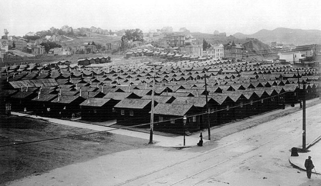
The railroad didn’t really compete until the last decades of the nineteenth century, when the demand for coal in Cleveland could only be met by the railroad. The region stayed pretty wild in the meantime. It was the canal which drew pioneers to the region, in the first stage of the state’s development, the canal right near our little Ohio town.

These conditions concur in Thoreau’s locale in the same era: his canal he and his brother paddled down was nearly out of service in his time, due to the new railroad.

***

Stepping back from the old Ohio and Erie Canal- and back in time- we have the river valley gouged out by the receding glacier a few thousand years ago. The turnpike spans the high level bridge, above our little canal ditch, and follows the ridge, once an animal trail and the track of the old Indian pathway adjacent to ancient Lake Erie- a history which goes back 14,000 years. And beneath, the little train station and the little iron bridge.

Chewey could care less. “C’mon Chew, lets go, boy!”

George Washington himself had dragged a forefinger along the rough map north to south, proposing the canal which would connect the Great Lakes-all of them- to the Ohio River, right by this spot, and on down the Mississippi to the sea again. The infrastructure would include Erie Canal to the east coast of America, and so connect the entire United States.

High stakes indeed for Chewey’s little ditch of leaves this winter day.

***

So we took a picture. I have it here before me, of my family, all smiling, winter holiday, 2003. Everyone healthy, thank God, smiling, standing at what was once the very westernmost edge of the United States.

And behind us, the great bridge, with its concrete spans, arches which, reflected in the river below, complete a circle. Bridge, and history, and family connections, and even my ineffectual life all have a place here, right here now. Smile!

The picture is dominated by the roaring turnpike bridge behind us, but to the right and almost out of the picture is the little iron bridge, the first iron bridge of its kind in the region.

It’s the little history bridges I revere, the ones Chewey and I are afraid to cross.

-Oh, on the way home we saw a deer.

jk

San Francisco

6-25 -04

***

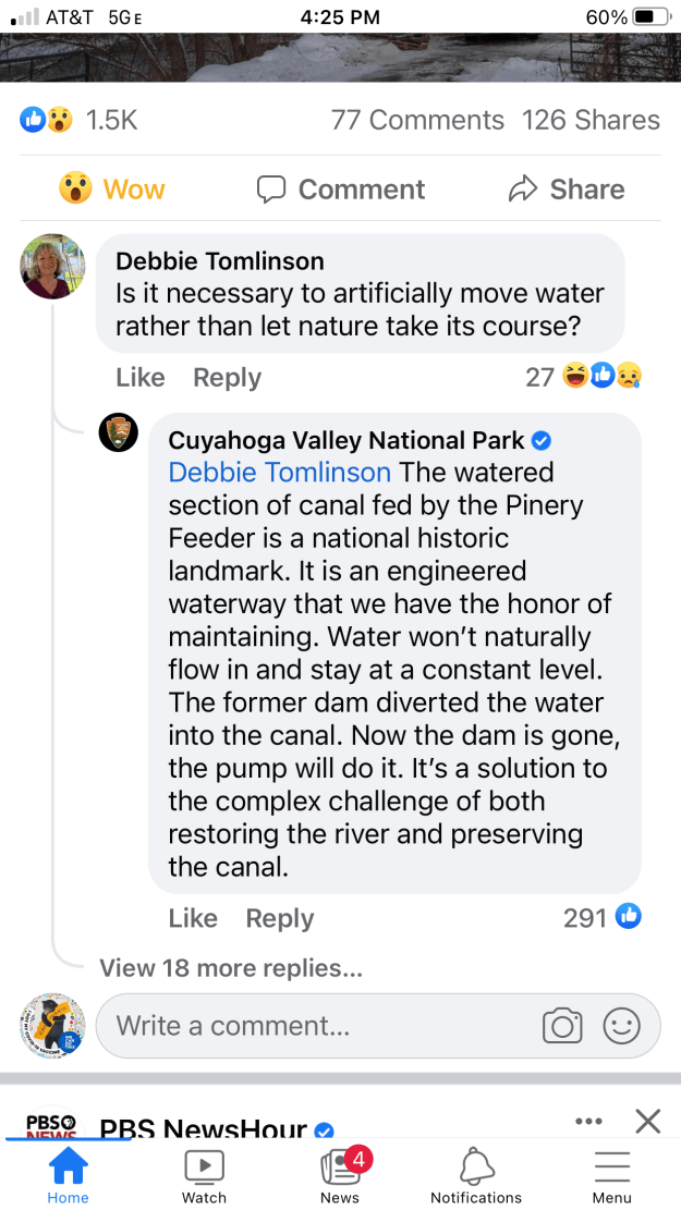
Just a reminder to all: the RR tracks north of Station Road/Brecksville Station are still closed due to eagles trying to raise their young.

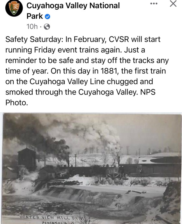
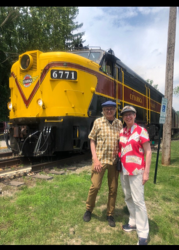
#TBT: Today in 1880, the new Cuyahoga Valley Line was in its second day of service, linking Cleveland with the coalfields of Tuscarawas County through the Cuyahoga Valley. This Saturday and Sunday, passengers can still ride through a pastoral landscape in the valley on that same line, but in heated comfort. For ticket info, see http://www.cvsr.com Image courtesy K. Summers.”- Facebook post for CVNP

***

We picked Gingerbread House Day to reveal our 2022 #GreatNPSBakeOff entry. This scene celebrates a milestone in the Cuyahoga River’s recovery. In May, scientists caught the first bigmouth buffalo ever recorded in Akron. This long-lived native fish was able to swim upstream from Lake Erie after two dams were removed in the national park in 2020. The dams used to divert water into the Ohio & Erie Canal near the historic Station Road Bridge, shown in sparkling silver. Once so polluted that it burned at least 13 times, the Cuyahoga River now supports diverse wildlife, including bald eagles and river otters. Explore the Station Road Bridge area in person or virtually at https://www.nps.gov/cuva/planyourvisit/explore-the-station-road-bridge-area.htm. Help share this success story! Gingerbread and photo by Kelly McGreal, Conservancy for Cuyahoga Valley National Park.

***

Today in Cuyahoga Valley National Park history, the Ohio & Erie Canal National Historic Corridor was designated in 1966. Today, let’s take a moment to honor those that built, thrived and faced life’s challenges on the canal.

Pictured here is a northeast view across the canal, just below the mile 14 towpath marker at Wilson’s Mill. The boat was lived in by a repair master.

Cleveland Public Library Photo: A family stand on a canal boat, behind them is a large white colonial style building and a barn.

***

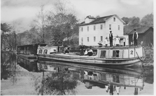
Life is a balancing act. As part of the Cuyahoga’s recovery, we try to give it space to flow where it wants. However, there are trails, roads, bridges, and train tracks nearby. To protect those, we have a major riverbank stabilization project in progress. The contractor is wrapping up north of Station Road Bridge. We’ll let you know when they move south. Native plants will be added later. Please continue to respect trail closures. Photos: Construction Support Solutions/Roberto Yaselli.

Rest With Me by the Shaking Earth (California beginnings)

Rest With Me by the Shaking Earth

(California beginnings, one of many)

from notebook; San Francisco’s Great Earthquake/ Centennial

***

A memory stands between myself and the great earthquake and fire. The memory is of an old amusement park in Ohio called Geauga Lake Park. We’d go there in the middle of summer, in the absolute heat of July, and on Lake Park Days the park would be full. It was all wood and wire, with a roaring, rumbling roller coaster, and plank pavilions, with bumper cars with upright poles that snapped with live electricity. The wires cracked like a whip in the summer air.

The sounds of the amusement park, of the rumbling of heavy cars, the rolling barrel you ran through, the spinning wooden wheel you leapt upon and got thrown off of; the merry-go-round, too, rumbled heavily as it turned, but it was the cumulative clatter and wooden roar of the park I remember, the thrill and the electric snap of the rides draped with wire and cable, like some dangerously mad Edison experiment.

Suddenly, up out of the sky above the amusement park would come a massive storm. There was hardly any warning, but the trees would become a deep green, and the sky, purple, like an enormous bruise. Then the sky blackened and huge preliminary drops of rain fell, and then sheets of storm, and bolts of lightning and then- the whole crowd, as one being, began to head for the exit. Hundreds and hundreds of people hurrying, grabbing children, and rushing for the gate.

You’d look back through the walls of rain, stealing a last look back at the fragile crazy structure of the giant roller coaster, which stood against the dark sky, and framed the park- a contraption devoted to the semblance of danger- but suddenly faced with the real thing, you can’t believe that you actually got on that thing, and good thing you weren’t up there when the storm hit.

San Francisco has some of these elements of danger: it roars and rumbles and snaps. Its traffic howls through the tunnels under Broadway and Stockton. It rings and dings and tinkles with little bells. Its hills are skateboard dangerous. You drive without brakes half the time, and other half you’re on the cell phone and a wrong move can change everything. There are too many swinging doors and buildings aslant, and joints akimbo- and that’s on a normal day. At any time a bridge can become unhinged, a building sway like a hula dancer from the Sandwich Islands, and instantly the infrastructure is compromised.

I was thinking of these things last weekend on a peaceful April San Francisco day, when I was playing with my five-year-old friend Miles.

We’d spent the morning building a train town out of his wonderful wooden train tracks, with switchbacks, and sidings and parallel loops and still more switches and bridges. There was a farm in the middle to provide for the town, and a cow on the roof, and several trains chugging, by battery power, past the living room scenery.

In a moment of artistic pique, young Miles took off his shoe and lobbed it across train town and took out approximately two feet of track; the Infrastructure was definitely compromised. The track was twisted out of alignment, the cows went a-flyin’, and the trains in the immediate vicinity of the meteoric shoe were derailed, and tumbled into a multicolored pile of plastic. The Velcro shoe rested at a forty five degree angle against the twisted mass of train cars, and presumably some imaginary train-town news channel would cover it all live.

It was the centennial of the disaster and fire of 1906: what are the chances of San Francisco being hit with a tennis shoe?

Later that afternoon, Miles and his mom Gretchen and I drove up to the Randall Museum, ‘way up on the hill of Corona Heights. It’s one of the highest points in town, uplifted by a million years of San Andreas action down below in the subduction zone. The museum has displays of animals and birds, and activities for kids, and we’re having a good old time. They have a replica of an earthquake shack there, which I’d never seen.

The earthquake shacks were structures hastily provided for the camps of refugees from the Great Earthquake and Fire of 1906. I didn’t know the earthquake shack was right inside the museum. I was looking at the museum display of the seismograph there, and then walked through a doorway of a quaint little cabin right there inside the museum, and within was my friend Gretchen, sitting by the door, reading from a book, and there at her feet, her son Miles was listening to a story she extemporized, and she said, this is it, the earthquake shack.

I looked around at the space: enough shelter for a small family, a lantern on the wall, and my friends smiling up at me.

History is so easy-going sometimes. It’s quite deceptive. But I enjoyed the grace with which the city was opening the door to some deeper memories, collective ones, from one hundred years ago.

***

The park occupies high ground. It sweeps down a hillside in a dramatic way both visually and physically, offering a view of the entire city and its bridge to the East Bay, the San Francisco Bay at the far edge, and in the middle distance, the collapsed and devastated Mission District, now rebuilt on made land.

It would have been an advantageous place to witness the fire. You could see the whole thing from up there.

A photograph of Dolores Park on the morning of April 18, 1906, shows the park in the foreground, the great early morning fire in the background, a massive pall of smoke which looks to engulf both north and south of Market Street. All this in the distance beyond Mission High School, beyond the still, quiet park. A boy in the foreground is connecting with the photographer, but saying something, engaged as a witness. The park is nearly empty, but for these two witnesses, and a few figures clustered at the lower corner.

It is astonishing to see this quiet scene of witness in the empty park, for soon the rough grass and dirt will fill with refugees from the firestorm and from the demolished section of the Mission District. To me, it is a pleasant place of sand and swing sets. It is a familiar neighborhood playground for young Miles and his playmates, and, like Golden Gate Park, and Mountain Lake across town- places Miles knows well for slides and swings and little picnic lunches with his mom, of crackers and juice- these city parks were the first recourse for those that lost everything in the Earthquake and Fire.

Another photograph was taken from the high hill at the west side of Dolores Park, around the corner from my sister’s house on 18th Street. The fires south of Market have now spread in a dramatic swath through the entire Mission District. A pillar of fire above Market is now an appalling black smudge, a volcano of smoke, and now the park has perhaps a half dozen large white tents pitched on the high ground. In the foreground, a few feet from the photographer, a man walks by with a bedroll on his shoulder and an open umbrella. The tents and the progress of the fires could provide a timeline for the photo. The razor-back hill of the park conceals the low ground near Mission High, which doubtless contains refugees and makeshift camps by now.

In time, Dolores Park was crowded with refugees. Conditions were reported to be appalling, the fertilized ground now wet with rain, the makeshift camps thrown down anywhere in any space not already occupied. But the park seems to have provided at least some of the immediate exigencies of survival.

From Dolores Park, where cook fires on brick stoves heated soup or beans, one would have seen the ruined hulk of the downtown district still smoking. A photo shows a makeshift kitchen, right across the street from the high school, which was a relief station for refugees. There it stands, dug into the earth, a half-face camp with a roof of uneven planks, beside a row of tents, with a woman before it, stirring a pot by the fire, on its little stack of bricks, the caption reads “makeshift shelter dug out of the mud and manure in Mission Dolores Park.”

There were crowds at the Mission High relief station, “long lines and confusion,” according to one account. A Public Health Service physician called it “a deplorable state of affairs. There must have been more than 30,000 people living in shacks, tents, and other temporary abodes in this district. Those whose homes had been spared have to cook in the streets, as all chimneys, water and sewer connections have been destroyed by the earthquake.”

Within months, the makeshift camps of Dolores Park were cleared and reorganized into “Camp 29, Mission Park.” My stroll up 18th Street in the final block before Church, a few doors from my sister’s house, would have, had I been walking in 1906, led past a Dolores Park half-filled with earthquake shacks, an array of over five hundred of these, roof to roof.

There are photographs of Camp 29. The camp is a large square of earthquake cottages, and appears to be newly created; it is a picture of order. 18th Street is swept clean. A distinctly new street lamp stands at the corner of the cottage city. My sister’s partner Lou looked with interest at the streetcar tracks on 18th, now long gone. “Yes, that’s 18th Street, with the streetcar tracks…”

The official report and requisition allows for five hundred and twelve three-room cottages for Mission Camp 29. On October 19th it is established and could accommodate

1, 599 people.

***

A poetic text of the Great Earthquake and Fire exists in the public mind. Some can quote the familiar, chapter and verse: “The City Hall was a magnificent monument to greed and corruption; the refugees left the city in orderly and somber silence…”

Photographic scenes would translate well to stained glass, as would my favorite image, that of ladies and gentlemen atop the hill at Lafayette Park, standing with their backs to us, looking outward at the pillar of fire. One woman only turns away, and so, toward the present, toward us. Her head tilted slightly, reaching with fingertips toward her face. Is she turning to cough, or to burst into tears? Is she overcome by the enormity, about to faint, unable to communicate her emotion to others, as they watch, transfixed, as the first day’s fires take the city down? Does she know what her companions still don’t see, that the life they knew is coming to an end?

“… In three days the fires were out though the company safes were too hot to touch; cash bust into flame if safes were opened too hastily…”

That large print of Lafayette Square hangs in Green Apple Books, where I went to look for earthquake books. I stopped to stare at it a long while.

Prints and photos and blaring headlines on yellowed front pages are ubiquitous, tacked on walls at many bookstores around the city. They are the literary wallpaper of local culture, as instantly recognizable as the psychedelia of the Haight-Ashbury.

The San Franciscan Victoriana of Doom, and stereotypical art of the Sixties, the Beat Poets and jazz- these ghosts haunt the Great Earthquake and Fire, and the earthquake haunts them, though I can’t prove that. For me, they are all mixed together right now.

And to complicate things, when I look at a photograph taken on April 18, 1906, I feel that it is me that is the ghost. I am out of place, knocking on the glass, as if those watchers at the quake would turn and respond.

The veil is quite thin, now, between past and present. I wonder about bleed-throughs. We have mixed feelings about revisiting this history.

A native San Franciscan, commenting on 1906, told me that society is held together by very delicate filaments, right now. At the time of the photograph of April 1906, there were perhaps social codes which carried the society through the disaster. As he told me this, I looked in a book at the enormous photographic panorama of the ruins of San Francisco taken from air- from a “captive balloon” looking out over Nob Hill.

I floated there, ghostlike again, far above the ruined city, thanks to the aerial photograph, while my friend told me of his sorrows, his deep disappointment in society, in politics; his mixed feelings about the injustices and high-mindedness of the old San Francisco; and his view that the new San Francisco is covertly violent, gang-ridden, with a prevailing mindset which in the end devalues people.

T-shirts and blue jeans and road rage and the mindless pursuit of junk; the lack of courtesy, the lack of respect for others…My friend talked about these things as the Captive Balloon hovered in space above April 1906. As far as I could see, the ruins were still smoking, and, fascinated, I lived in two worlds for a moment, listening to the one of April, 2006, and looking intently-in real time- from

the air above San Francisco, in April 1906- at a San Francisco as barren as the moon.

So the photographs call to us, as if the San Franciscans of 1906 were to finally turn from the fire and look back, and engage us with a moment of contact.

jk

San Francisco

April 9, 2006

Rock History: a Geologic History of San Francisco (California beginnings)

California beginnings, one of many.

Rock History: a Brief Survey of the Geologic History of San Francisco

***

“seismic gift”

ground has shifted.

Things might not be where you left them.

stuff toppled off shelves or at ominous tipping points

roots exposed

Rivers

changing course

or running backwards

That quiet place with the cool shade’s gone

Long view open to landscape light

It’s ok

Home has shifted in relation

Always there

Geology exposed

Outcropping to read

time capsule

you and I

Pipes have cracked water leaks

Rivulet promise garden

A building razed opens a walk

High above the strand below

One walker

our walk together

dogs still playing with the sea

Heart moon still there!

Roads sliding sideways

New alignments

Possible

You have to clean up this!

Throw out that

Never knew we had this

Damaged goods now

This is still good

My beloved still thankgod

Some look for meaning

Others get to work

***

Rock History: a Brief Survey of the Geologic History of San Francisco

San Francisco is dominated by its natural features, and famous for the tectonic drama of its earthquakes and fault lines. Yet its geologic history is, for many, still a puzzle. The explanation of its topography is still not widely understood, though geologists have made great advances in piecing together the story of Northern California’s creation and evolution.

From them we learn that the uniqueness for which Northern California is known has a geologic foundation, metaphorically speaking, for as the distinguished geologist and author Mary Hill wrote, Northern California was “pasted” on to the continent eons ago.

When geologists look at the rocks in San Francisco they see a chaos that comes from somewhere else, a melange that, until recently, utterly defied explanation. The region was never completely native soil; the fault lines undermined the sense of permanence and coherence that pervades the United States throughout the rest of the continent.

The geologic history of San Francisco is a constant presence, which, through dramatic landscape, connects the city’s inhabitants with the events that formed the western edge of the continent; it set the pattern for San Francisco’s metaphors of migration and creativity.

San Francisco topography: drastic hills, upon which multimillion dollar homes perch precariously, and twisted roads through colorful neighborhoods to views overlooking San Francisco Bay.

Beyond are the Marin Headlands, ancient, severe, connected to the city by what is still a most modern suspension bridge, at the Golden Gate.

From San Francisco’s central promontory, Twin Peaks, one can see in all directions an astounding view of low mountains to the north; to the west and southward, the rugged but regular shoreline of the Pacific Ocean.

Eastward, one looks down nearly a thousand feet and across an expanse dominated by the city below: seven square miles, with its abrupt hills and flatlands at sea level; and beyond, the huge, peaceful bay estuary with low-lying East Bay hills in the distance.

The beauty of San Francisco defies analysis, yet a unity underlies its mystique; it makes sense, in some undefinable way.

Looking down from Twin Peaks one sees a wonder, or an oddity, of the world. Part of the mystery is not logical, but geological. Geology, the study of rocks, and lithology, which attempts to explain sediments and formations, have everything to do with the creation of San Francisco and with its romantic allure.

Clues to the creation have long been known, but explaining the origin of rocks of San Francisco and the nearby Coast Range presented a challenge to geologists for nearly a century. Geologist Deborah Harden, author of a standard textbook on the subject, describes “the bewilderment of early geologists who encountered the rocks of the California Coast Ranges…the rules of classical geology were not sufficient for geologists to explain the origin of the rocks they saw…a baffling mixture of different rock types, jumbled together with enormous complexity.”

Eathquakes were known, of course, but the theory of plate tectonics was not. Though the topography of the Northern California Coast Range is an obvious geologic unity in its basic northwest configuration, following the Pacific coast, parallel to the peninsula on which lies San Francisco, the relations of all these natural forms was never understood until the theory of plate tectonics was advanced and effectively demonstrated in the 1970’s.

Plate tectonics deals with the solid structures, the fractured masses, which, combined, form the earth’s surface. The concept of crustal plates in motion was associated with a discovery that had to do with the spreading ocean floor: mid-ocean ranges, their sediments and volcanic rock were accumulated and displaced, and eventually driven into deep trenches beneath the continent’s margin, a process known as subduction.

These concepts underlie the theory, and explain the intriguing contiguity of the continents. Continents appear to be fractured fragments of one original whole, known as Pangaea, and the actuality of ocean floor spreading proved to be a force driving them apart over multi-millennia.

California may sometimes be imaginatively pictured on the western edge of this great Paleozoic supercontinent more than 235 million years ago, this from Richard P. Hilton, in tracing the geologic background of prehistoric California for a book on the state’s dinosaur past. Hilton explains that the very oldest rocks, of mineral limestone content and thus of marine origin, were found in the Klamath Mountains of the northernmost part of the state.

It is surmised from this ancient evidence, that California began as isolated, distant islands, which gradually migrated to the continent’s coast- which was then what we know as central Nevada. That is the starting point of our geologic history, ever driven by plate tectonics, the earth’s device for creating the ocean floor and continental crust.

The volcanic, ocean-spreading phenomena of mid-ocean, forces the matter of ocean plate into ridges, and islands like the Klamath feature noted above, and troughs, and deep trenches at the continent’s edge.

Forced by the spreading ocean floor in a dynamic called subduction, plate under plate, smashing rocks were jammed, uplifted, their stratified contents in horizontal levels now upended to the vertical to create the mountains of the Sierra Nevada.

So also did compression at the edge crumple and uplift the Coast Ranges, where San Francisco is situated, somewhat like a broken link in the mountains’ chain.

Thus the western edge of the continent was formed. Yet San Francisco’s geologic hills, plied by little cable cars, were still thirty million years away.

Research into San Francisco’s geologic history seems to fall into two categories: the age of rocks, and the forces that brought them into existence as landforms. The rocks are old; the forces that brought San Francisco into being are fairly recent occurrences, geologically speaking.

Geologists Hill writes, “It was not until about three million years ago- just yesterday in geologic time- that the Sierra Nevada began to rise as a great fault block.” Much is still unknown, but the rocks that make up the hills of San Francisco offer substantial clues as to age and origin.

The processes described above, of subduction and accretion of landmass, have delivered enormous blocks out of the substance of the distant sea floor to form our various neighborhoods.

Much of the ingredient rock that makes up the city is thought to be 100 million years old, that is, of the Mesozoic Era, the age of dinosaurs.

Subducted sediments were shoved beneath the continental plate, up to twenty miles below the earth’s surface, for one hundred million years of compression, heat, grinding, crushing metamorphosis, to form the characteristic rock melange of San Francisco. The basic rocks that make up the city are referred to by geologists as the Franciscan Assembly. It underlies the central block of the city and much of the Marin Headlands, as well.

The melange includes sea floor and sediments, sandstone and shale, all a kind of metamorphic mud, which was uplifted a million years ago as land. Known as greywacke, it is the hard rock of Telegraph Hill and Alcatraz. (Ted Konigsmark’s “Geologic Trips: San Francisco and the Bay Area.”)

Franciscan assemblage also includes basalt and chert. Basalt is synonymous with ocean floor, a volcanic, that is, igneous dark rock that emerges in cold ocean as stone pillows upon contact with cool sea water.

Clyde Wahrhaftig, a pioneering San Franciscan geologist, tells us that the enormous edifice of Twin Peaks is basalt, as well as a substance called chert. The basalt is probably associated with the mid-ocean spreading zone, as well as with volcanic eruptions on the sea floor’s moving crust.

Radiolarian chert is a component of much landform in the Bay Area. Chert is prehistoric, skeletal matter of microscopic marine life, which rained down on the ocean floor over millennia, and so provides scientists with clues as to a rock formation’s origin and age. Though the skeletal matter is tiny it compounds over time into large rock masses, with a characteristic, layered intricacy.

The fact that the Twin Peaks edifice is made of such ingredients as once made up the ocean floor 100 million years ago is astonishing, especially when one considers that the chert’s silica probably descended to the ocean floor near the equator. The College of Marin’s website “To See A World Project” describes the origin south of the equator; thus it migrated northward along with basalt to emerge as components of Twin Peaks and Marin Headlands.

Chert and basalt are associated with of the tectonic Farallon Plate, which traveled hundreds of miles to the San Francisco subduction zone. The whole process is s matter of 140 million years, from sedimentation to uplift, so that in standing on Twin Peaks, one stands upon a piece of Jurassic ocean crust, to look down on San Francisco.

San Francisco is also founded upon serpentine, another ingredient of the chaos/melange. The Golden Gate Bridge is anchored near serpentine, and the large outcropping which overlooks the Cliff House and ocean is serpentine.

Serpentine is California’s state rock and has an exotic origin far below the earth’s crust. It is a version of peridotite, of which the earth’s mantle is made. (John McPhee, Assembling California). This deep stuff runs in a band from Fort Point to Hunters Point; it underlies Potrero Hill and the foundations of the Mint near Church and Market.(Wahrhaftig) Far from the earth’s mantle now, it is everywhere seen in a diagonal band across the entire city.

Greywacke seafloor sediments; basalt lava and chert from the deep sea; serpentine from the earth’s mantle, and metamorphic rock from subduction zones; hundred million year old rocks make up the enduring landscapes of San Francisco.

The final element is dune sand, much of it from the ancient Sierra, associated with the most recent Ice Age, when the coast, due to the glaciers’ retention of large amounts of the earth’s water, was out beyond the Farallons, twenty thousand years ago.

The geologic story of San Francisco is a modern experience. For all the great age of its rocks, the landform is relatively recent. The accretion of land to the continent’s end, and the processes of plate- smashing and subduction that gave birth to the West Coast, were mostly subterranean phenomena, until perhaps two million years ago, when uplift occurred sufficient to create a landmass which tectonically evolved toward the SF peninsula formation. (Arthur D. Howard. Geology of Middle California)

Hauled northward by the San Andreas Fault over 28 million years, various migrating landforms finally parked in the vicinity: Point Reyes, and the Santa Cruz Mountain formation, driving along before it part of the San Francisco peninsula. A great river cut through the Golden Gate on its way to the sea beyond the Farallons. And starting about ten thousand years ago, the San Francisco Bay, once a forested valley, began to fill, flooded by the rising ocean waters as the ice age glaciers began to melt.

Research has revealed the probable age of the rocks and their provenance as migrants to the coast, but still to explain are the curious hills of San Francisco.

That Twin Peaks stands above the city is probably a case of what geologists call vertical displacement, due to forces of compression along a thrusting strike/slip fault. Blocks may fracture, and be upended. San Bruno Mountain, in South San Francisco, is such an uptilted block.

Once upended, the forces of erosion take over. Everywhere, rigid rock remains; the soft shales and sediments erode off; this accounts for the flat regions of the city. Thus we have prominent hills, with steep eroded sides, and stretches of flatland, and wind-blown Holocene sand.

A final piece of the San Francisco puzzle remains, provided by geologist Ted Konigsmark. The city’s geologic map is banded by parallel blocks, basalt, greywacke, serpentine, and metamorphic rocks: each a distinct layer of ancient rock, one terrain piled on another, in a sequence of time.

“Stacked like pancakes” on a tilted plate, these rock layers were thrust into the subduction zone at a steep angle. Then, presumably through uplift and erosion, the parallel pancake edges, now upended, were eventually exposed as the street levels of the modern city- and so, north to south along the cable car line, one travels through time.

Looked at from a distance, the low bay, the flooded peak of Angel Island-a “drowned” mountain- one gets the sense of the eroded past of the city. (Wahrhaftig).

The bay is shallow, four fathoms to shifted sand. The deepest point, over 300 feet, is near the Golden Gate, where ancient river flowed. The ocean was the gate of migration, by ships from the south, traveling below the equator the long journey around Cape Horn in the Gold Rush Era.

Just as the rocks migrated northward along a transverse fault millions of years ago, a migrating population sailed in over decades. Ships of the newcomers and the entrepreneurs encountered the natural conditions of coastal fog. Many ships had tragic encounters with geology, running aground in sediments at Ocean Beach, breaking up against serpentine at Land’s End.

Eventually foghorns and lighthouses appeared point to point, and cable cars, and chaos and creativity. All of this is connected to the geologic history of San Francisco.

Because of the chaos of rock, and the modernity of the landforms, very few fossils exist here; fossils just don’t make it here.

It is interesting to note, too, that the theory that explained San Francisco to the world, plate tectonics, also explained the world to itself. Far from being an isolated phenomenon, or California trend, or a lunatic fringe at the continent’s margin, the creation of California is a good example of how the earth itself creates.

And for geologists the theory, somewhat like the discovery of gold, changed the world.

outcropping, devils slide

Why I Love the Mendocino Triple Junction (California beginnings)

Summer: Why I Love the Mendocino Triple Junction

(California beginnings, one of many)

-written after a 7.2 north coast quake, june 2005 notebook.

***

“I’ll have the Mendocino Triple Junction, please.” I know, it sounds like a banana split.

Or a fantastic train ride where the conductor calls out “Mendocinooo Triple-juncshunnn! All aboard!”

If the Triple Junction doesn’t kill you, it is somewhat like a banana split, or a train ride through time.

The Mendocino Triple Junction is the conjunction of three great tectonic plates, and it’s out there, I tell you, it’s real.

Now the Junction is off the coast about twenty miles, I think. Picture the most lonesome coastline of the sea you can think of, with high, bare coastal bluffs of rock, nothing but a few cows walking down the roadside of a two-lane highway twisting through its lonely pass and descending steeply to the sea and you’re there- at a place called Cape Mendocino. It is the part of California that stretches out to the Pacific furthest, the westernmost point, and standing there, alone, the wind messin’ up your hair, the cows walking by, and the sea like ruffled slate endlessly before you: You are looking out over the Triple Junction.

Thank you, scientists and mariners who figured this out, this whole San Andreas Shebang. I find it fascinating.

Last night we in California heard the Junction’s call: an earthquake, ninety miles out to sea, measuring seven point two magnitude, I think.

The Mendocino Triple Junction is comprised of three great ancient tectonic plates. Children, gather ‘round and repeat: North American, Gordo, and Pacific.

The big old Pacific one is under the sea, and bumping and grinding along the North American Plate to its east, it embraces and is doing a wild disco dance with the Gordo Plate in between. This sort of shocking ménage a trois got extra boisterous last evening about eight pm, and nearly caused a tsunami, but we were spared.

It was a horizontal movement of the plates, and so didn’t rock the water to create a massive wave. It did rock Crescent City though, and Eureka, and Arcata, I’m sure. These delightful little California towns are the last you come to as you approach the Oregon border, ‘way up there. They front the sea, in a haze of cool fog, with giant redwoods climbing remote mountains in the rear. A historic lighthouse at Crescent City holds its lonely vigil, while beneath the Pacific Ocean the great earth process creates and destroys and creates, like a heartbeat, over millennia.

Eureka has its old, stacked Victorian mansions, and Arcata its town square plaza and vegan breakfast menu. My wait person worked with horses and took classes at Humboldt State, the time I was there. And in the redwood forest a few miles to the left of my sunny omelet, and a few miles northward, one could see Roosevelt elk in the gravelly riverbed, and trees two thousand years old. Bump, grind, the earth dance goes on underneath it all. Erotic Earth, thank you, for creating this continent, and allowing this continental breakfast on dry land.

All this because of the Junction, the Mendocino Triple Junction!

Tectonic plates brought the sea floor to us and heaved it up as a gift of land studded with miraculous fossils; the sea floor overlooks San Francisco and is now its crowning hills waving with tall grass, cars wending by on twisty roads past wisps of sea fog. Tectonic plates in collision and subduction, ramming and jamming crust beneath, hauling up land in new combinations of mushed up rock, much of it dragged from far away in the Southern Hemisphere, and much of it 150 million years old. Big old scoops of delicious Franciscan Melange scraped along to grab every morsel and add to the continent, or to place on the continental shelf for later.

It’s delicious. If I have my facts straight, the old Farallon Plate was finally smashed up against our shore, and over eons it was subducted, thrust beneath the continent in an eastward movement against the unmoving western boundary of North America. When that old Farallon Plate was finally completely crushed, 28 million years ago (correct me if I’m wrong) the east/west tension of tectonic plates was compromised, and the plates began to trend north, creating the present San Andreas Fault; that web of fractures seen from above looks like a valley, all green and peaceful. But watch out, kids. The San Andreas has many moods.

So the Pacific Plate slides along the North American Plate, and carries northward landforms which became our home, sweet liberal Northern California, all hot tubs and peacock feathers. It took mountains from Big Sur and planted them north of me, at Point Reyes, against which our Spanish merchant explorers ran aground hundreds of years ago. Our beautiful coastline the Spanish would curse as they sailed by, because the Junction was bringing forth high mountains that rose right out of the sea, and those were covered with fog, and no place to land, no food, and no refueling station. California was saving itself for the right time, obviously, and though every town has a Spanish name, the relationship was somewhat strained. Why? It comes down to the Mendocino Triple Junction, and those plates creating California exactly the way it is meant to be, without regard for Man.

But wait, look at the array of lights, out over the San Francisco hills, across the bay at night, and far, far beyond low lying hills, into the heart of Northern California, Land of Gold. The fact that half of it is heading for Alaska shouldn’t disturb me right now. It’s beautiful, and it will still be beautiful when we’re gone.

How do I know this? Because the whole thing, I’ve learned, is recycling itself. It’s a big old Ce-ment Mixer, creating new gunk and churning down the old- nuclear plants and all. Trees and rock and everything.

And the “Ce-ment Mixer” is the new tectonic dance going on at the Junction. You can’t see it out there beneath the sea, but last night we heard about it.

A big sexy earthquake with a magnitude of seven: in terms of earth, that is heaven. For that’s creating the continents, a sign of Earth’s dynamic life. I know- run for your lives. Head for higher ground.

But without the Triple Junction at the end of my home fault, which starts down here at Frisco, and ends up there near Eureka, without all that, there would be no higher ground. Things around here would be mighty flat, and mighty wet. And at best, we’d have have fins and talk with bubbles, or sing with the whales.

So I love to stand at the remote, beautiful, lonesome rocky shore of Cape Mendocino, out in the middle of nowhere, with a few cows walking by, and look out over the great Pacific, and think of how, out on the horizon, and down below, the Mendocino Triple Junction is chugging right along.

We regard the Triple Junction with ease. We lean and loaf in California, like old Walt Whitman, at our ease, part of the Fault, the Junction, as relaxed as if we waited for a train, and thought, let’s have a triple scoop with sprinkles.

We’ll prepare for the next one.

7/15/05

https://www.google.com/search?q=june+15+2005+quake+California&ie=UTF-8&oe=UTF-8&hl=en-us&client=safari

The Mudflats of Yerba Buena. (California beginnings)

California beginnings, one of many. from the early notebooks.

The Mudflats of Yerba Buena.

Walk along the mudflat along Yerba Buena at night in the 1840’s. You could be walking a barely filled space, a track of boards and sand and trash, a length of “street” would suddenly disappear into a hole, and so would you, a short swift drop into the cold bay waters. Fifty six drowned that way- at least.

That is our explanade, our promenade, our embarcadero, in the time of arrival.

Now, sadly, I walk at night, on the concrete, far out into the former bay.

I actually miss the mud I heard so much about, and the trash, the piled up loads of ships, and the greasy lantern light in the dark out by the Plaza, a dignified term for the little ramp by the post office, with the drunks falling out, and the wind whipping the first sparks that might set the whole town aflame.

The bay is too shallow for all but a rowboat or a filthy plank, and the ships are all gone, but the dark waters still reflect a little greasy light at night, a reflecting glow, off into stillness of those drowned islands in the night: Goat, Wood, Alcatraz, to utter darkness of the endless bay beyond.

There was plenty of darkness in the nights of whale oil time, plenty of murder and mayhem punctuated by the occasional public hangings, duels and assasinations.

Out in Happy Valley, Market Street’s workers’ district, there were no lights, but fires, and noise and brawls, and working people and shanties and boilers. The crude medieval industries of early San Francisco: fish smells and foundries, smithies and boat repair, so at night: Darkness, aforementioned fire, shouts and nails and knives and more trash to trip over. Danger everywhere in a quiet stroll.

Beached ships and boats in the mud and at night it would be hard to find the water’s edge. Rats run on a plank to your saloon ship. And no way home, even if you had one, which you do not.

City of the homeless, all the way back to its beginnings.

And darkness also owned the various peaks- that was wilderness up there. Who is ever going to go up there?- with the cruel wind blowing walls of sand in your face, making a mockery of your efforts at civilization.

But there you see: banked on the vertical hillsides, the famed illuminated tents and sails of Yerba Buena.

Other than that one cannot see a goddamn thing.

The nearest cemetery is less than seven modern blocks away on a hill of sand next to a dune of sand with sand still blowing in your face, sand to sand, and your market district is a pueblo, nothing more.

So when and if they haul your corpse out off the baymud, there you’d be, in your impermanent resting place. In the center of a Spanish town made of dirt, with a plank road out those three miles to the Mission of the Crying Lady of the Sorrows by the Laguna of Tears and a creek and a marsh- and where is solid land, again?- and another cemetery of the first inhabitants, your neighbors, they too lie in ground that grows nothing, in ten thousand year old Sierra sands longing for the sea to wash it all away here in 1846.

“Dear Mother, we have just arrived. We saw a grizzly bear chained to a tree. The land abounds in opportunity, I have no doubt I shall succeed at last.”

Monterey; an Evening Walk. (California beginnings)

California beginnings- there are so many. From a travel journal.

Monterey, an Evening Walk with- and without -history.

An artist makes a bold line; such is the course of this bay, inevitable and remarkable as Vizcaíno the explorer saw in the year 1602: a broad, perfect, convex curve of water which can only be appreciated from the vantage point of the Discovery Site. Indeed, it is beautiful from my park bench by the shore.

It’s a study of blue with many little boats that pose with masts leaning slightly, moored and balanced and poised throughout the bay. It’s a simple scene to behold, even the first explorers claimed it was just a circle of calm water, that you’ll know it when you see it. Just head from the rocky point east from the Pacific when you see the pine trees, Punto del Pinos, and look for the beach.

The 1602 explorers’ report is unabashed tourism, a veritable postcard to the King, wish you were here. The latter day visitors didn’t recognize it at first, and so sailed right by. Is this it? Is this Monterey? Are we there yet?

Of course I found it right away, though I nearly missed my exit, which in modern times means you’re stuck on Highway 68, driving in concentric circles to get back to your destiny/ destination.

But finally there it is, Monterey’s defining arch, Fisherman’s Wharf on a sunny first day of fall, on a beautiful afternoon. I parked at a little beach nearby called San Carlos and got out of the car to stretch. I found out later that I had rediscovered the discovery site, for here a ship first landed. Here California’s Spanish era begins, and so its (recorded) history begins.

Monterey has a significant role in the creation of California, though it is part of a continuum, of course, like a skipping stone on the calm surface of the bay before me. Not just the stone counts for something, but the ripples, too. It was the capital, the focal point of strategic access for the Euro-incursion led by Spain beginning in 1542.

I looked for beginnings, even for misleading ones, in books and historic sites, leaving to serendipity and to Rough Guides history’s latest revision.

From the wharf, I doubled back to scan the layout and stopped at a food mart to get some bearings. The food mart was right next door to the RLS house, where Robert Louis Stevenson stayed in the 1880’s near the center of old Monterey, just up the hill from the bay. I found a motel right there with a beautiful indoor pool and a hot tub, here in the year two thousand- something. Then I ventured out to find history.

I reconnoitered on a sunny afternoon, but took my walks by night. I had Monterey mostly to myself.

What Monterey isn’t: It’s what it is not, that got me thinking as I looked from my bench across the silver blue green grey bands of Monterey Bay, with its ribbons of kelp and dolphins that leap in astonishing unexpected arcs.

What it isn’t: It’s not a factory job or the crush of rush hour traffic. It’s not scurvy on a Spanish Death ship; not “gold fever” or endless prosperity, nor military prowess or religious fervor.

It’s not the hammering nails of the Southern Pacific, or the Big Four that ran California in its gilded age of growth. It’s not the good-natured merchant/nation builder Thomas Larkin with his house in the middle of town, nor the dusty-robed Father Serra who founded the old Mission, and whose bones rest in peace near the opulent golf course just over the hill.

All these left Monterey behind, it seems, a rather sleepy town of old adobes and modern low-storied structures. The notable absence of high rises makes it easy to imagine Monterey’s former incarnations one by one.

Here you walk a historic map, up a tilted mesa; up one walks a gentle slope, ten blocks to the 1790s church and its Presidio above town.

At the foot of the hill, the bay. You can hear the barking seals all over town, especially at night.

I saw most of the historic sites after sunset, encountering Monterey’s treasured old adobes, one by one. Each little site is illuminated by a low street lamp and marked by a cream-colored sign with the family name and approximate date.

It is an 1830s version of Monterey I walked through, pre-Gold Rush era, in its small square adobes with red tiled roofs, its relaxed layout, clustered on the Calle Principal.

Old Monterey was a community the language of which was Spanish, and it was destined to be the Califonios’ capital, even after the American takeover in 1847. Much of the old atmosphere is still accessible to the imagination today. A history walk with the tourist map I found remarkably rewarding.

John C Fremont, Willian Tecumseh Sherman, Robert Louis Stevenson, these are the presences one can picture ambling about. It’s not that long ago.

And a whole raft of painters: impressionists, plein air people, painters of romantic moonlit nocturnes. Painters -and writers.

One forgets what is real on an evening walk. Does the old barracks still exist? The old Whaling Station? If I knocked on Gen. Sherman’s little wood door in his little stone house of a warm evening, I was afraid he’d answer.

In modern times the downtown’s streets of shops culminate in a landscaped section of hotels near the wharf and the shore that was once “Cannery Row”.

My night walk takes me past the scattered adobes, their low walls of stone and mud-brick, back down to the old Customs House where US and Spanish and Mexican and indigenous cultures once converged- still do.

Here at Monterey, a potential antidote to scurvy and disease and despair of the long voyages of the Manila Galleons, the Spanish ships on transworld trading missions which had only begun 50 years before its inception, in the 1560s.

For fifty years the ships had taken the currents from Japan along the rugged California coast, haunted by the forbidding sight of Cape Mendocino: no place to land, to refuel to recover, on the long voyage to established ports in Mexico. These were commercial ventures, not the kingly missions of the Church- though the Pope, in a political quid pro quo, blessed the venture of Spain and Portugal, starting the first gold rush to the New World.

Forces in motion? Not here at night with the barking harbor seals and the marauding raccoons around the stilts of the wharf over dark water.

This is a scene of stasis.

Next to me, on the next park bench over, a woman toyed with her cell phone which emitted beeps and fanfares, while I looked straight ahead, thinking of history, looking at the shimmering water and kelp.

And when I get up, I can walk along Lighthouse Avenue in the moonlight, retracing the route to the sea.

Mountain Lake. (California beginnings)

Mountain Lake encampment, San Francisco.

-California beginnings, one of many.

***

(In 1772, explorer Juan Bautista de Anza proposed an expedition to Alta California and on January 8, 1774, with 3 padres, 20 soldiers, 11 servants, 35 mules, 65 cattle, and 140 horses, Anza set forth from Tubac Presidio, south of present-day Tucson, Arizona. In 1776, Anza ended his 1500 mile journey at Mountain Lake, in present day San Francisco).

***

Mountain Lake is near a street filled with rushing traffic, but is tucked behind the row of houses, and trees line the walks, insulating the traffic sounds.

The late afternoon birds were active around the margins and in the overhanging branches, the lake itself was placid beyond its protective fence. There were joggers at this after/work hour. Most smiled as they went by, which was an unusual perk for the pedestrian- most San Franciscans look dead level ahead and beyond, and never exchange a glance if it can be avoided. Here kids played along the rocks at one end of the little lake, and I sat for a few minutes at a bench near the stands of tall grass that grow at the water’s edge.

Mountain Lake is the only natural lake in the vast Golden Gate Recreational Area, and here, it is said, Anza and his men halted in their careful reconnaissance of the SF peninsula, at the end of the journey north in the 1770s.

I was startled by the sea. I didn’t expect to see the Pacific from out on 15th Avenue, as the beach is ‘way out at 48th, but the north-most tip of the peninsula makes its round a half mile from where I stood, and I didn’t doubt that the seasoned explorers noticed the lay of the topography in an arc from the west to the north, that is, from the Pacific Ocean to Mountain Lake, with a nearby river of fresh water and the nearby commanding lookout over the entrance to the bay. No trees, so the open hills provided a clearer view in all directions, I would guess.

Though not barren, the pleasant woodland we know today was more typically a sandy ocean/prairie grassland in the early centuries of recorded history. Although it must have had a bleak beauty, with sun and fog, there was a potential for re-supply by sea, and a footing for a fortress out of the wind, within a few miles; all boded well for future settlement.

Anza’s report stated they had pretty much everything they needed right here, and not far, they planted a cross to mark the site they chose for a Presidio.

The land explorations are amazing for their duration- Anza had journeyed from Tucson-twice- and books tell us he knew what he was doing. He supplied his troops with the best equipment, and brought a strong, experienced little force with him here to the lake.

I read the park signs, and appreciated the beautification project. Flowers and native plant species and fresh diggings and plantings. Anyone can volunteer to weed it and it’s obvious that people do.

The sun was dropping into twilight as I took the nearby Lobos Creek path, by the prairie environment the naturalists are creating, it is quite lovely, especially as the daylight fades, and the light changes in the various grasses and pale flowers. Gone are the bright and vivid garden flowers of spring; this little walk has the tans and browns and grays of grass and thistle. It’s quite nice.

I couldn’t see Lobos Creek, the fresh water source that encouraged the explorers; hidden in foliage, it moseys along the treelined ravine on its way west to the ocean at Land’s End.

It’s was there long before our arrival, and unnoticed it will remain, long after we’re gone.